Type: naturalistic, landscape, and cultural
Approximate distance: 49 km – 67 km (Abbadia San Salvatore Variant – with charging)
This itinerary crosses the physical and symbolic heart of Monte Amiata, connecting the natural dimension of the mountain with the human, artistic, and communal intervention that shaped its western slope. It starts from Santa Fiora, gradually ascending towards the summit area, where the landscape changes radically in climate, vegetation, and perspectives.
⛏️ Abbadia San Salvatore: the abbey and the mine – The Mercury Route
(Variant – OPT. with charging in Abbadia San Salvatore)
The first major stop (if you opt for the variant) is Abbadia San Salvatore, where two fundamental souls of the Amiata coexist. On one side, the Abbey of Santissimo Salvatore, founded in the Lombard era, which for centuries represented a religious, cultural, and territorial control center; on the other, the mercury mine, one of the most important in Europe between the nineteenth and twentieth centuries.
The Mining Museum of Abbadia San Salvatore allows for a direct reading of this transformation: tunnels, plants, documentation, and stories restore the industrial dimension of the Amiata, explaining how the extraction of cinnabar deeply affected landscapes, urban structures, and the living conditions of the miners.
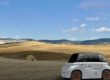
⛰️ Amiata Summit: walking the highest point
The itinerary reaches the summit of Monte Amiata, one of the widest panoramic points in central Italy. The ascent can take place in two ways, both designed to integrate car and walking:
- driving up to the summit, and then walking along the ski slope up to the monumental wrought iron cross that crowns the mountain
- or parking at Prato delle Macinaie and using the chairlift, when operational, to experience the ascent as part of the experience
In both cases, the summit offers ideal spaces for short walks, extensive views, and a clear reading of the Amiata as an isolated, dominant, and central mountain in the surrounding territory.
🌲 Rifugio Gen. Cantore: the lived-in wood
From the highest point, you descend towards Cantore, one of the most frequented areas of the Amiata for outdoor activities. Here the woods become a lived-in environment: trails, clearings, and equipped areas recount a contemporary use of the mountain linked to trekking, breaks in nature, and slow enjoyment, in continuity with the historical vocation of the area.
🎨 Daniel Spoerri Garden: art in the landscape
The route continues, in the direction of Seggiano, towards the Daniel Spoerri Garden, one of the most surprising places on the itinerary. Here contemporary art dialogues directly with the landscape, without forcing: sculptures and installations are inserted into the ground, among woods, olive groves, and slopes, creating a visiting experience that combines walking, observation, and reflection. It is a stop that offers a different reading of the relationship between man and territory, more symbolic and intuitive.
🏘️ Castel del Piano and Arcidosso: community and territory
Descending towards the valley, you reach Castel del Piano and Arcidosso, two centers that recount the western slope of the Amiata as a space of community, labor, and territorial organization. Here the mountain translates into daily life, markets, inhabited villages, and still very lively social relationships, before returning to Santa Fiora.
🏘️ Santa Fiora: the museum and mining memory
The return to Santa Fiora allows one to close the circle through the Mercury Mines Museum, which completes the story begun in Abbadia (if the more articulated route was chosen). Here the mining dimension is read from the perspective of the community, daily life, and social memory, offering a more human and less industrial picture of the extractive epic.
Why choose it
An ideal itinerary for those who want to read Monte Amiata as a complex landscape, where nature, human intervention, and industrial history coexist without contradiction. Alongside the mining memory, the route passes through natural environments of great value, including the vast Amiata beech forest, considered one of the most extensive artificial beech forests in Europe, a result of the far-sighted forestry policies promoted by the Lorraine family between the eighteenth and nineteenth centuries.
The mountain thus presents itself in all its dimensions: productive and natural, exploited and protected, shaped by man yet still profoundly wild. From the summit to the Cantore woods, down to the villages and mining communities, this itinerary is perfect for those seeking a complete understanding of the territory, where landscape, resources, and memory intertwine along secondary roads and wide-ranging environments.